
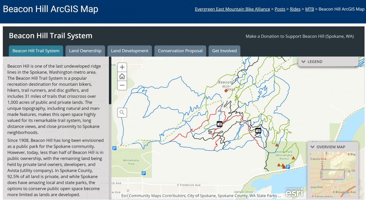
For many that live in or near Spokane, Beacon Hill has been one of the few public open spaces that folks can access close to home. It’s an important and treasured green space, with a remarkable trail system – but did you know that 61% of the trails at Beacon Hill are on private land? Do you know which trails are on public or private land? Check out this new mapping tool to learn more about the Beacon Hill Trail System and the plan to conserve this amazing resource.
Some cool features to check out while using the web map on your phone:
 If you are viewing this map from Evergreen East’s website, first click the “open a new tab” pop out symbol in the bottom right corner of the map (this will enable the “show location” feature described below).
- To quickly find out if you are on public or private land: 1) scroll to Land Ownership by swiping left at the bottom of the screen, 2) click the locate button in the upper left corner of the screen (it’s the button that looks like cross-hairs).
- The “i” icon in the upper right corner of the screen displays a description and legend.
- Click features on the web map to open pop-up windows with more information (e.g. trails, photos, parcels).